
Reliable, informed and timely data is cited as the key unlocking Africa’s potential by the African Development Bank (AfDB), and rightly so.
Powering good governance, accountability and accurate policy making decisions to name just a fraction of its applications, data has become one the most valuable tools of the 21st century.
Having contributed $100 million to improving the continent’s data quality, reliability and cross-country comparison, the AfBD has been able to successfully help address a number of institutional, infrastructural and legal-capacity changes.
But the AfDB is not the only one.
Facebook, a company renowned as a global cultural phenomenon since its foundation in 2004, is equally looking to play its part in transforming social development through the use of data on the continent.
“Facebook’s mission is to give people the power to build communities and bring the world closer together. And our mission in Africa is no different,” James Gill, Software Engineer at Facebook states. “We achieve our goals by investing in communities such as startups, developers, and agencies around the continent.”
With more than 139 million people across Sub-Saharan Africa directly familiar with the social media stalwart’s platform, the firm has used its reach and reputation to champion a multitude of progressive programmes.
From its #SheMeansBusiness community empowerment programme and partnership with the Nelson Mandela Foundation in raising awareness about gender-based violence, to operating both the Facebook Community Challenge programme that supports social development and the Facebook Challenge at Loeries – an effort to facilitate digital opportunities, the company has become renowned as a sound corporate citizen in recent years.
Its latest development, however, is arguably the most impactful to date.
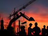
Combatting continental challenges
Combining world-leading computing power with extensive data science skills and expertise in machine learning and artificial intelligence, Facebook has created the world’s most accurate population density maps.
Three times more detailed than any other such technology, the company’s team was able to accurately map 110 million buildings across Africa after scanning 11.5 billion images in just a few days.
“On the technical side, we’ve developed spatial algorithms that work with interesting computation graph topologies, novel labeling techniques, and applied state-of-the-art research in machine learning that collectively stand this technology apart,” Gill reveals.
It is on the impact side, however, that the technology is expected to plant its most sizable, positive footprint.
Gill continues: “When we talked with humanitarian organisations about their technical challenges, it became clear that obstacles that were insurmountable to them could be done on Facebook infrastructure in a month. By leveraging our skills and resources, we’ve been providing these groups with the information that lets them focus on what they do best: helping the world.”
This in mind, Facebook has been working with key non-profit and research partners, using its population density maps to help address large-scale social, health and infrastructure challenges across the sub-continent.
Orchestrating action
Having already been deployed in a host of different ways, the world’s fourth most valuable brand has a range of case studies to showcase this technology’s success.
Working with the Democratic Republic of Congo, for example, the Gates Foundation has been using it to improve the way health workers are able to reach households with information about forthcoming vaccine distributions and verify young children, allowing them to receive vaccinations.
Meanwhile, cooperating with Humanitarian OpenStreetMap and the Reiner Lemoine Institut, Facebook’s population density maps were combined with detailed data on settlement structures to help identify and prioritise prime locations for off-grid energy solutions.
The Missing Maps Project in Malawi also used the population density technology to filter our 97 percent of the country’s uninhabited terrain, helping to coordinate the efforts of 3,000 Red Cross volunteers in visiting roughly 100,000 houses in just three days to educate people about measles and rubella vaccines.
“A number of our partners are equally currently using the density maps to better respond to the Cyclone Idai and better understand the potential spread of disease in Mozambique,” Gill explains. “Similarly, we have teams looking at population density maps in parts of Equatorial Guinea to better inform malaria eradication models, as well as groups interested in using our maps for solar projects in Ethiopia.”
Now a core part of Facebook’s Data for Good portfolio that aims to build privacy-preserving products to help solve some of the world’s biggest problems, the firm is expecting its impact to be widespread throughout the coming years.
Gill concludes: “We believe when data is shared responsibly with the groups that need it, it improves how non-profits do their work, how researchers learn, and how policies are developed. Given that this release just took place, we anticipate there will be extensive scale and impact, not only this year but into the future as we look to roll it out over new countries and continents.”